An exciting post! Now I’ve never been the hiker sort and i used to look at liz&fred and think that it’s cute they both like to go hiking tgt cuz i would never do it with the BF cuz both of us are just.. lazy. LOL. But then in my second final week in Seoul, I was looking for places to travel to, and somehow I stumbled upon the mountains page and i had that consideration in mind. Like maybe… i should hike up one of the mounatins…?
Thus started a long night of researching, texting Sheryl and finding out which mountain I should hike. The best mountain in Korea as said by many bloggers and CNN travel, was Bukhansan. I went to find out more about the different peaks so i can decide which peak i should climb. I read that Baegundae was the highest peak and there were different paths you can take to reach there. One of the trails was only 1.9km long but it starts from Baegundae Information Centre when i asked Sheryl about it, she said that starting point was kinda ulu and i couldn’t find any info on it too. So I decided to embark on the most popular trail, the 3.4km one.
There were still some friends around in Korea but one of them moved in their clique of 3, Zenn definitely wouldn’t hike, and so I didn’t bother to ask and just decided to hike alone. Haha. Personally i felt like the hike had to be done alone actually. Because it was my first time actually hiking a challenging trail, I wanted to find out my own limits without the pressure of having someone else with me.
Honestly, I feel like learning to be alone was the best lesson I’ve learned from being on exchange. I don’t know how to say it, but I felt like those who hadn’t learned to be alone, end up compromising a lot of their wants and needs for others. Learning to be alone doesn’t make you a loner. It just means that you’ve learned to enjoy your own company, you’ve learned to feel it’s perfectly okay to be alone even if others think you’re a loser or smth, and it means being able to go out and do your thing alone without feeling lonely or wishing someone else was with you. I think learning to be alone is one of the most difficult things in life but also one of the most useful. You become so strong… like you can be with people of course, but you can also be alone. Learning that skill makes you pretty indestructible. Like okay you don’t wanna go with me? You don’t want to jio me to your outings? Meh…. that’s totally okay with me. I’m just gonna go out and like travel the whole Seoul by myself. it’s like NO ONE CAN DESTROY YOU. It’s the best thing I learned from exchange honestly.
Anyway back to the point. So after deciding on that peak and that trail, I rested early the night before and had a nice hearty breakfast in the morning before setting out.

Not that hearty la actually
I didn’t set out that early actually, I left around 11am. By the time i actually reached the entrance of Bukhansan (after getting lost), it was already almost 1pm.
Stocked up on my supplies. Had a bottle of water and a bottle of isotonic, a bag of chips, two kimbaps and a bag of snacks. It wasn’t enough tho, I had to buy another bottle of water at one of the rest stops.

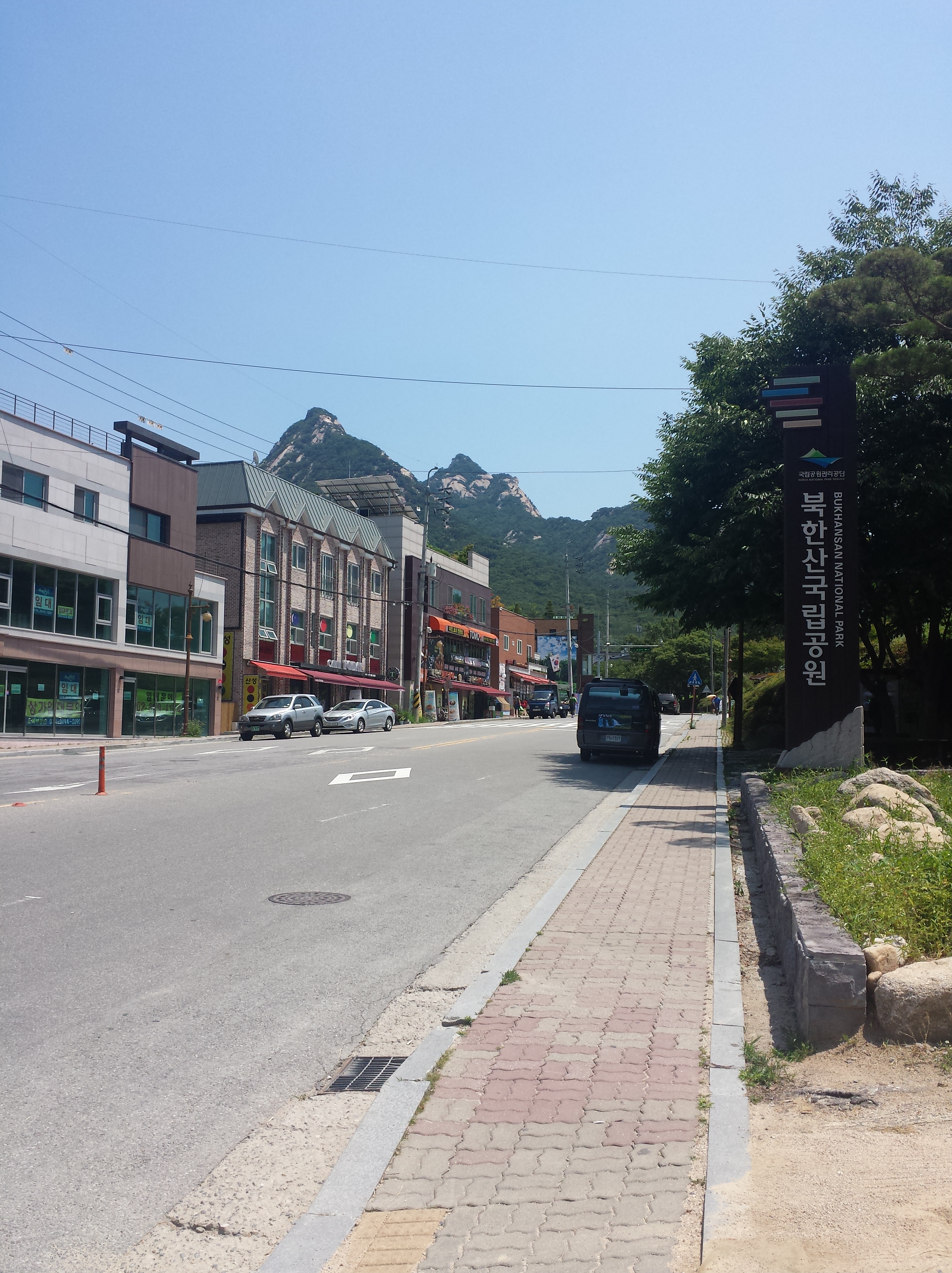
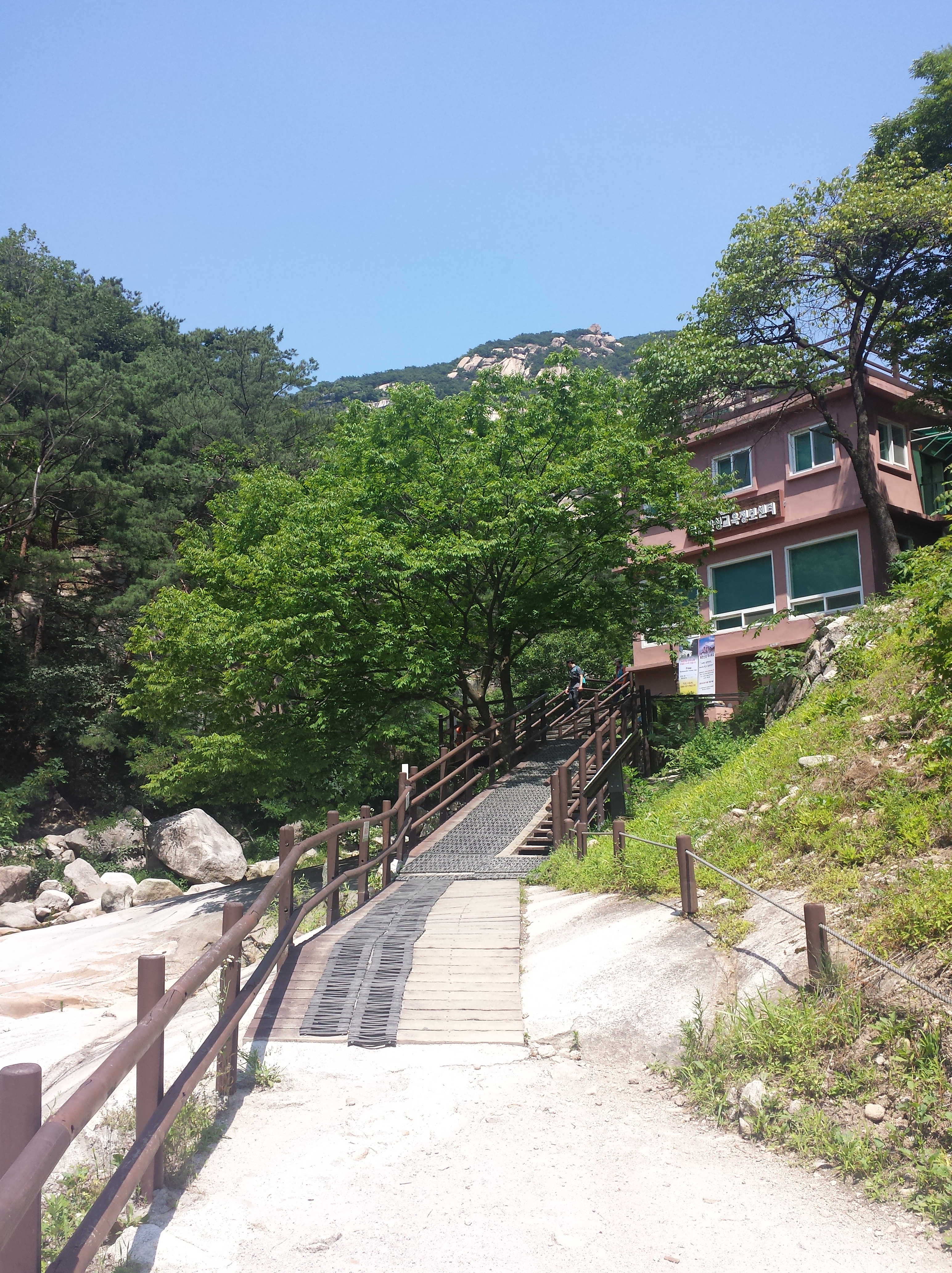
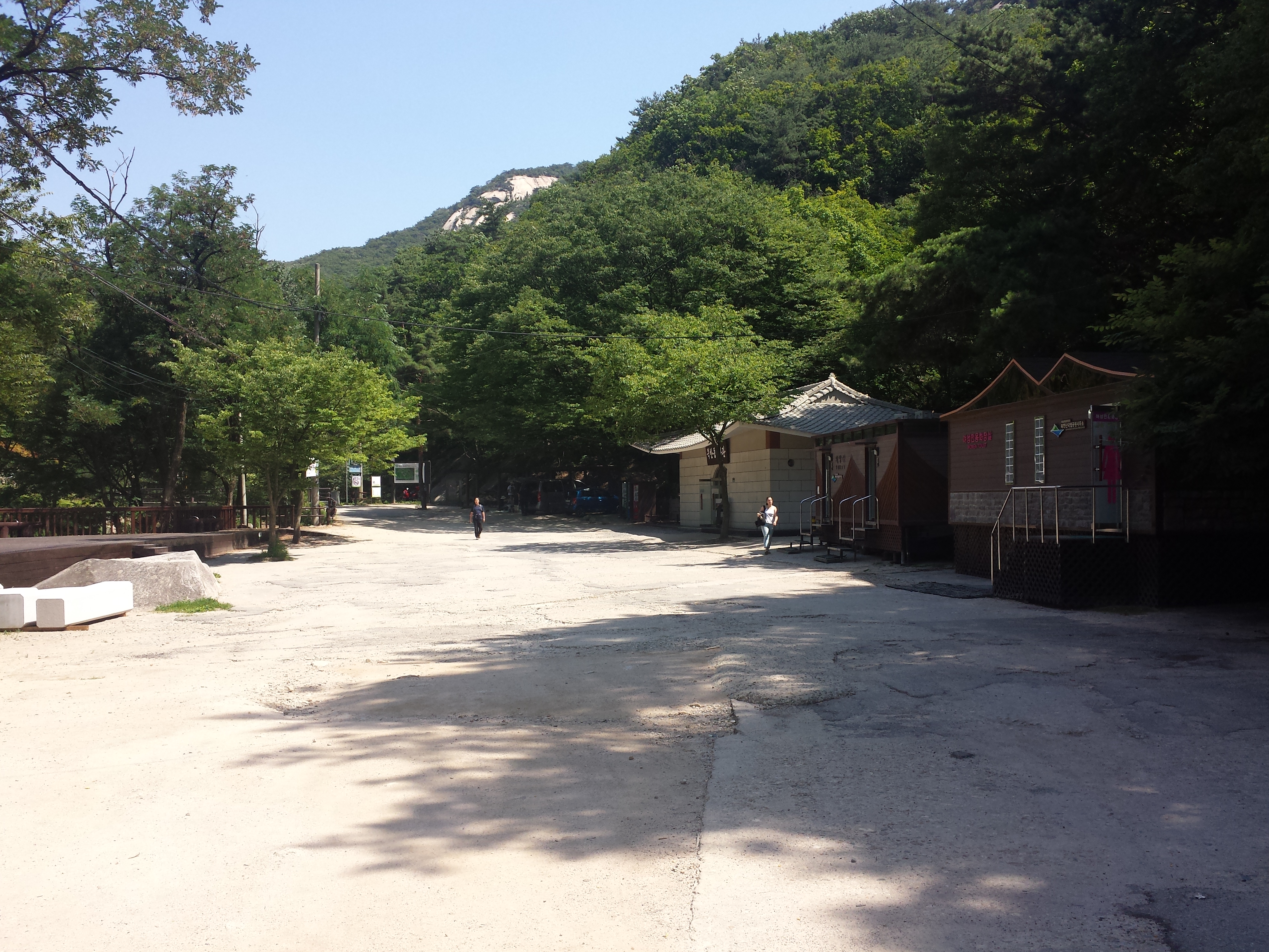
Entrance to Bukhansan
The entrance to the trail up wasn’t that obvious actually. I got a little confused but I confirmed with Sheryl that there was this row of shops along the beginning of the trail.

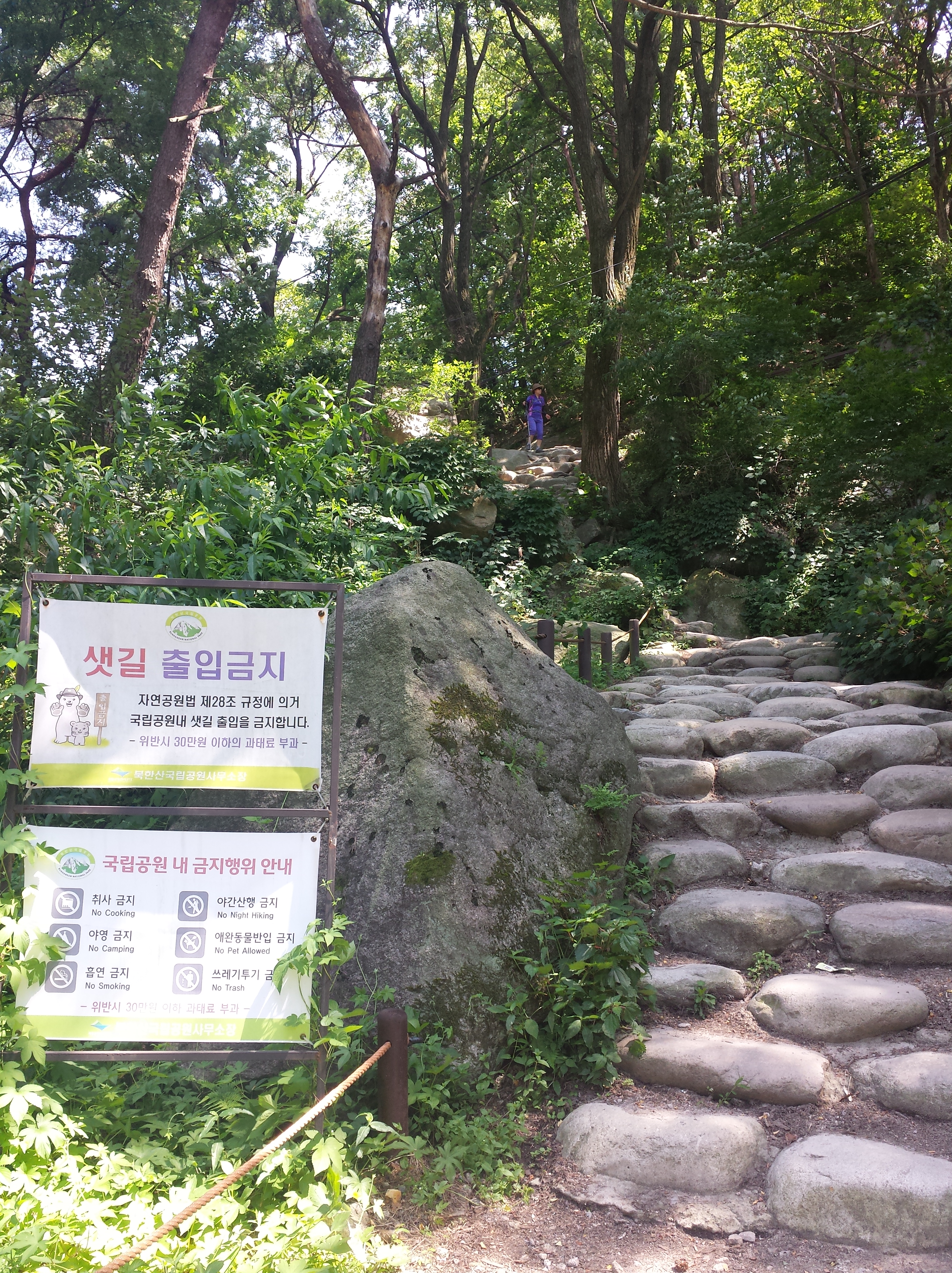
You’ll walk past a little counter and a toilet point as you start on the trail up along the shops of houses. Unlike what most sites are saying, you don’t have to pay entrance fee or book in advance. Things have changed I think. Walked for a bit and saw the first signage/checkpoint.

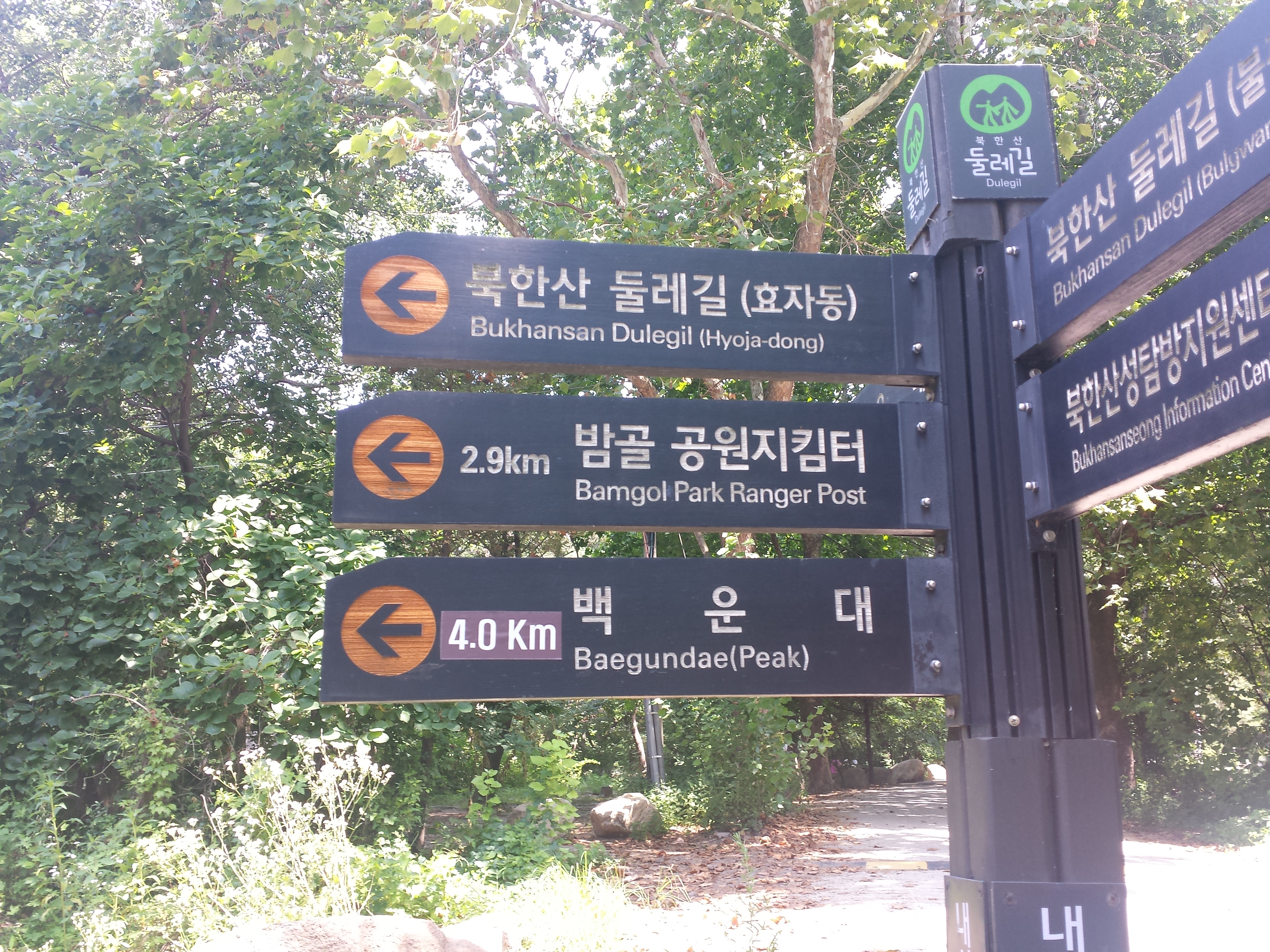
Okay when i saw this i was like WTFFFFFF I feel cheated because no it’s not 3.4km, it’s 4km!!!! I think that makes a lot of difference esp if you’re talking about 600m upslope. For Bukhansan you can’t quite trust the official site or the tourism sites, like things change and they’re not exactly updated. I think the 4km trail was the same 3.4km one they were talking about but the distance just… changed over the years lol. As you can see the 4.0km was clearly a separate plate nailed onto the old one.
At around 130pm it was a nice clear weather and i was enjoying myself taking pictures of the beautiful sights around me. At this point my mood was happy and confident. This is a random sentence but you’ll see why I need to say this now….

The trail to a separate peak

Nice clear weather with plenty of shade


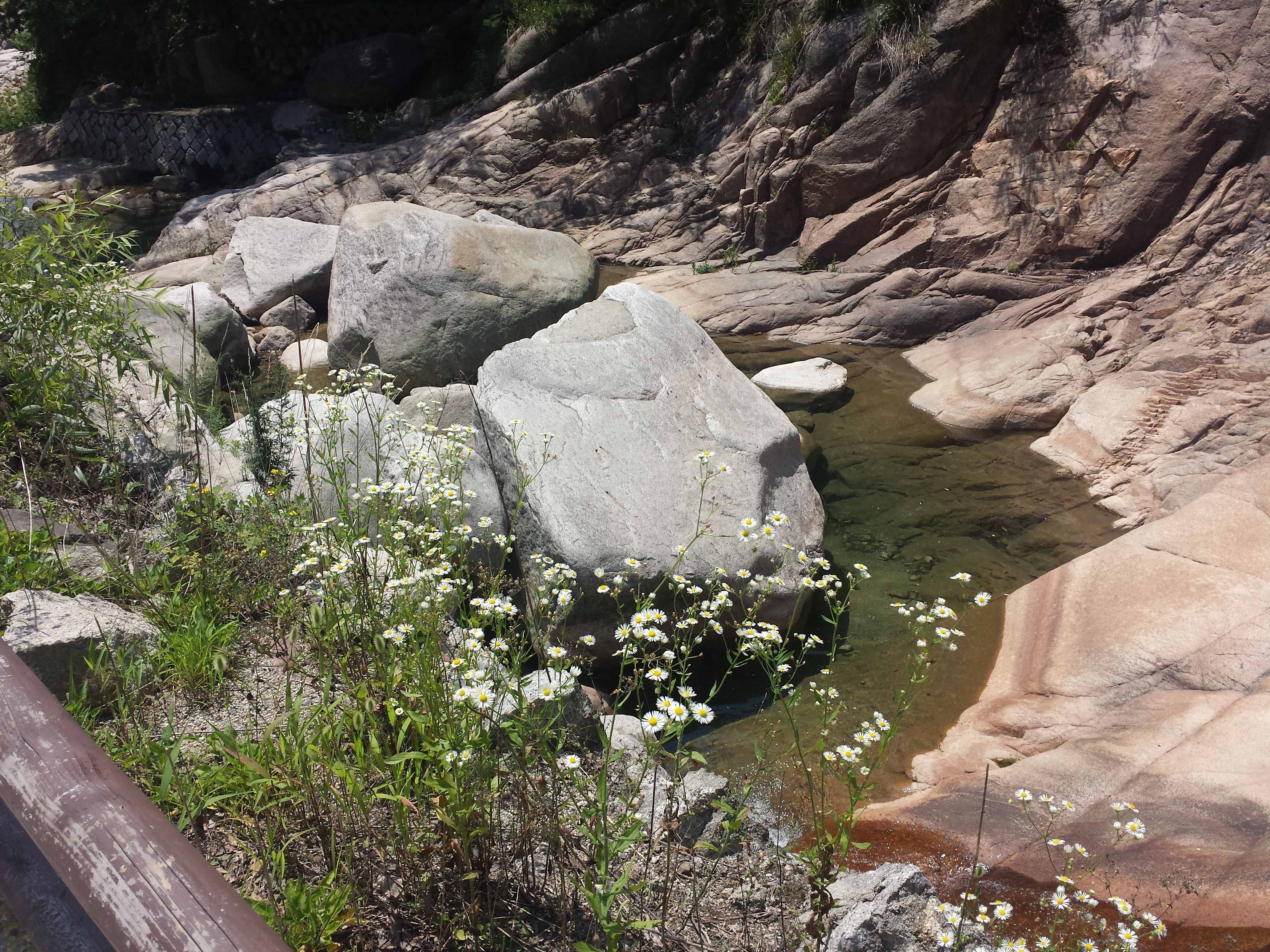
There were also pretty streams along the way and I stopped to take photos, rest and take some selfies haha.


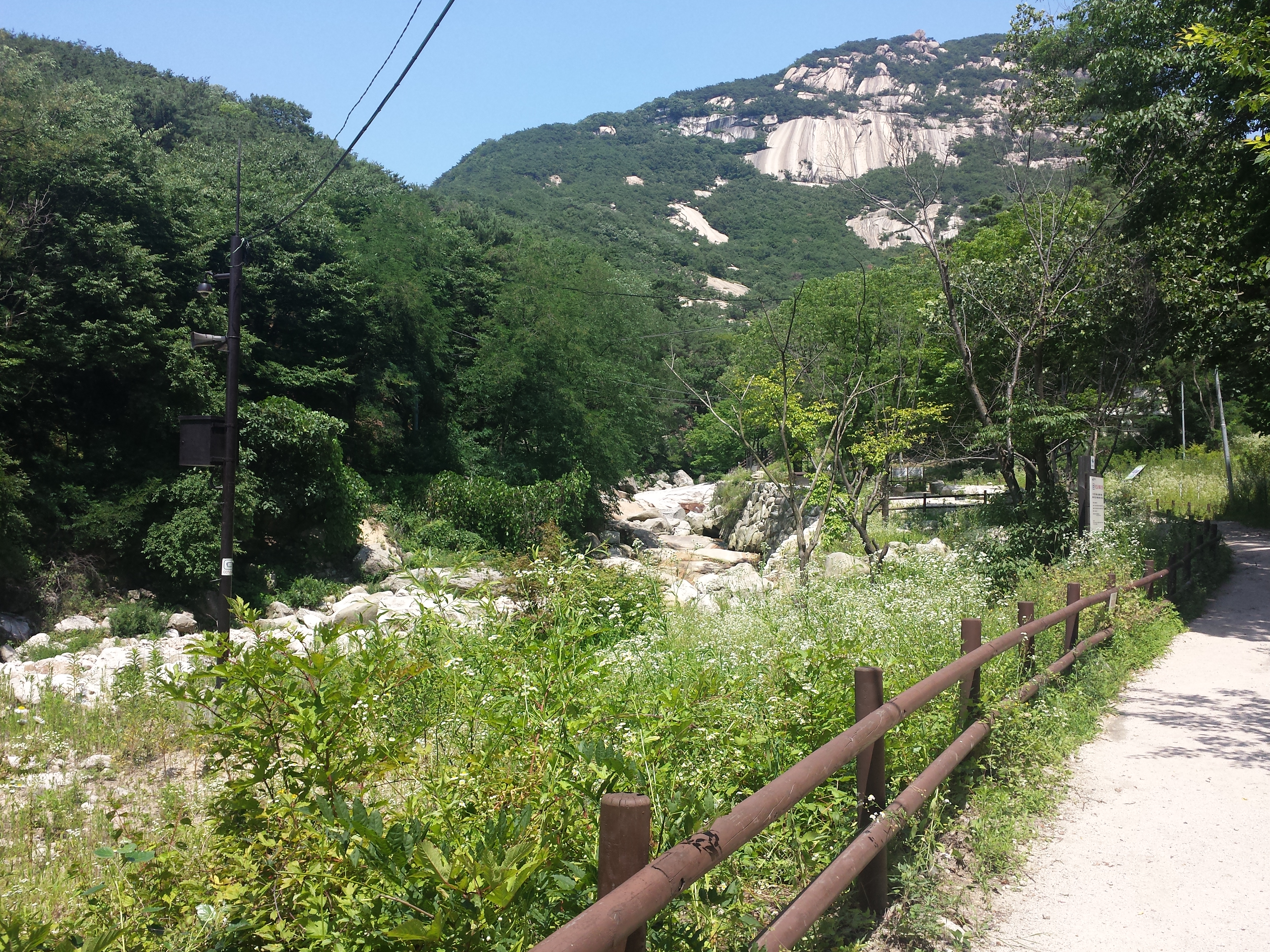
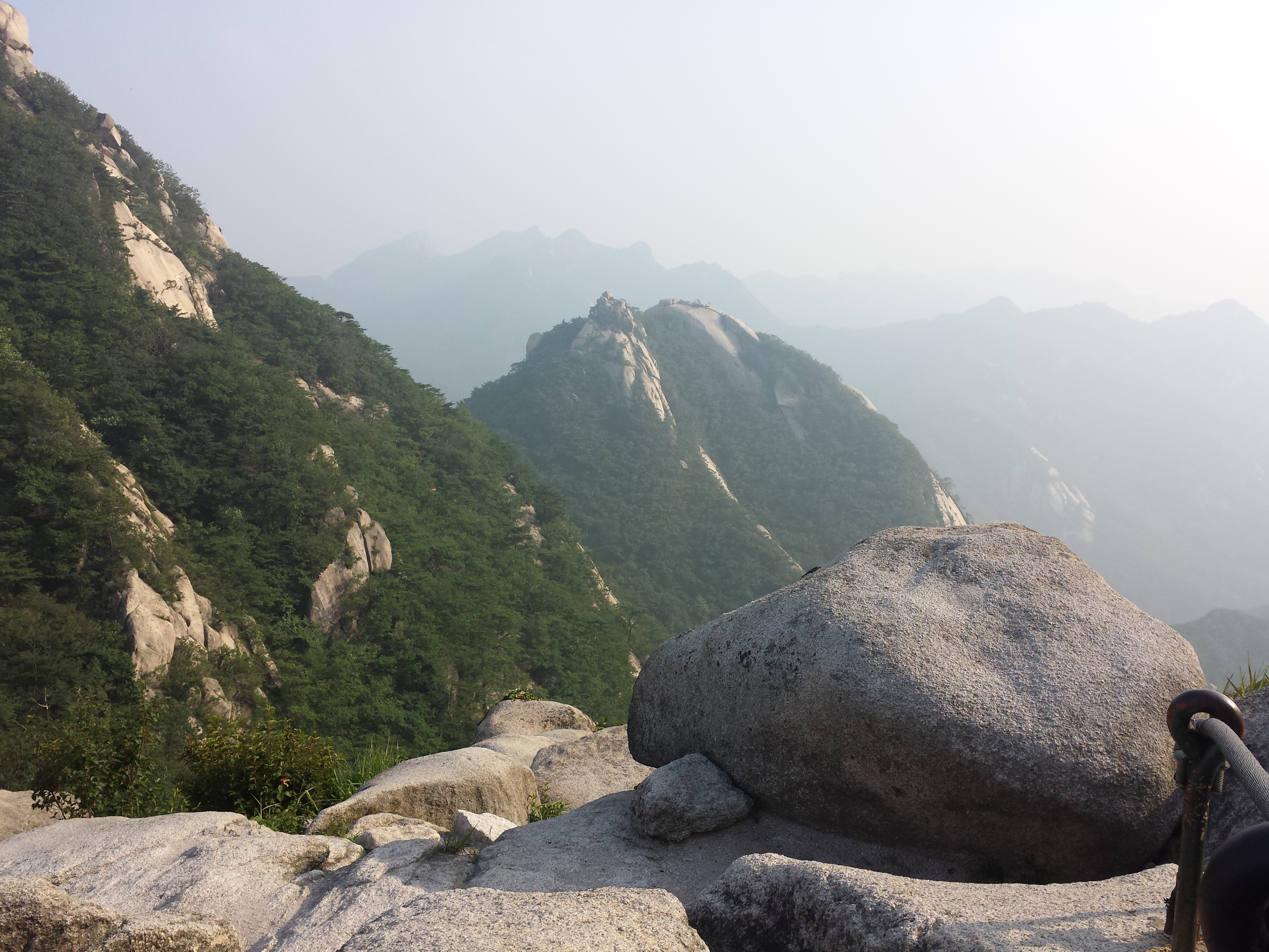
The first part of the hike was truly beautiful! Loving all the beautiful sceneries that are mostly untouched by man. The clear sun also made my photos come out super nice. At this point i walked past some ahjussis who asked me where I’m headed to. I said Baegundae and they let out a collective gasp and gave me a thumbs up and told me to return. That sounded borderline scary but i was thiking like nahhhhhhh they’re prolly just exaggerating.
Then I reached my 2nd checkpoint, 3.5km away from Baegundae. I dub every signage i walk past as a checkpoint haha.

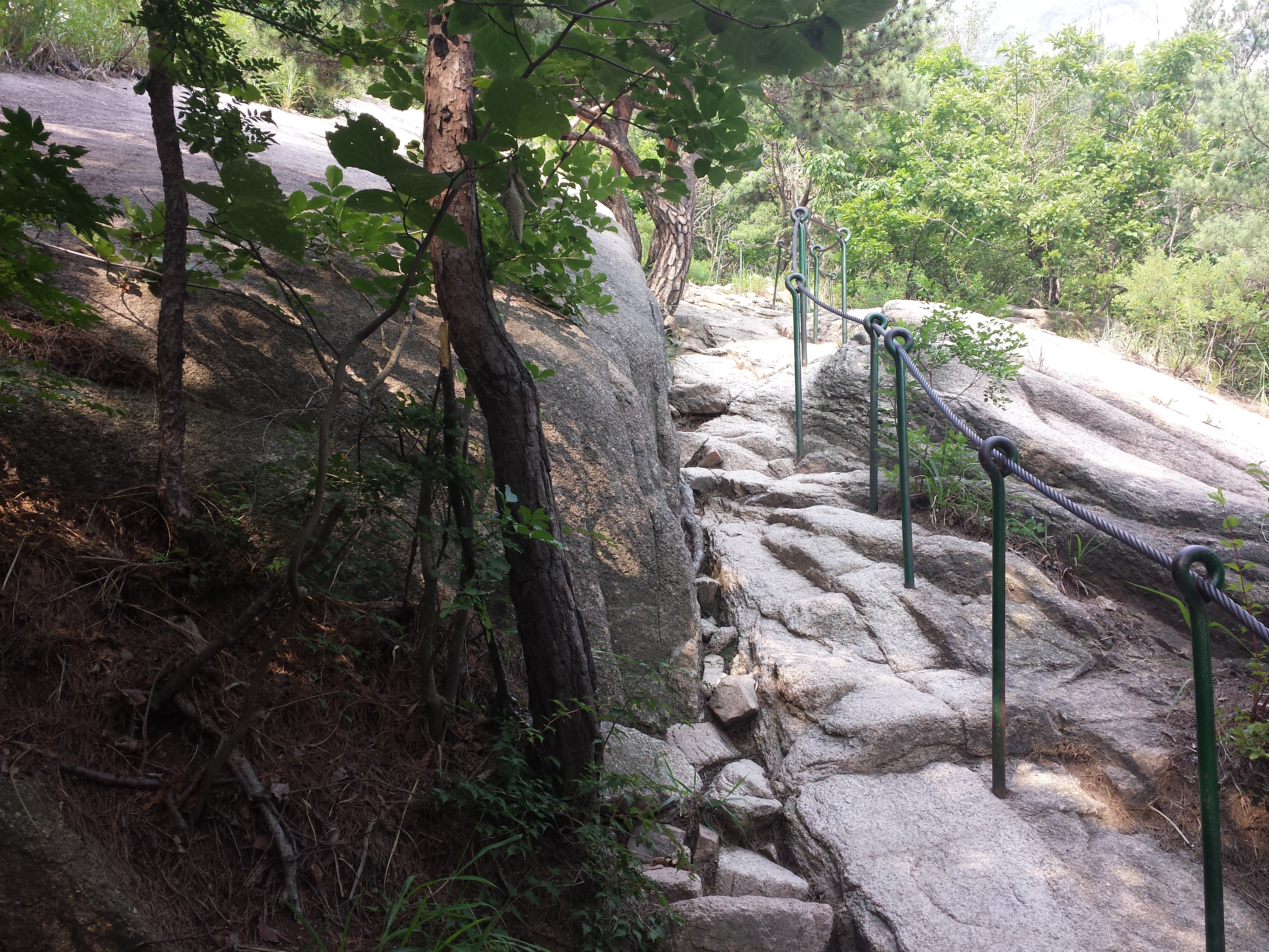
This was when the upslope actually started.

When I saw this slope, my mood was a little bit uh-oh but well it’s not steep so I embarked on it still cheerful and all. I walked past another stream and this one was so pretty! Just look at all that clear water:

dat clear water
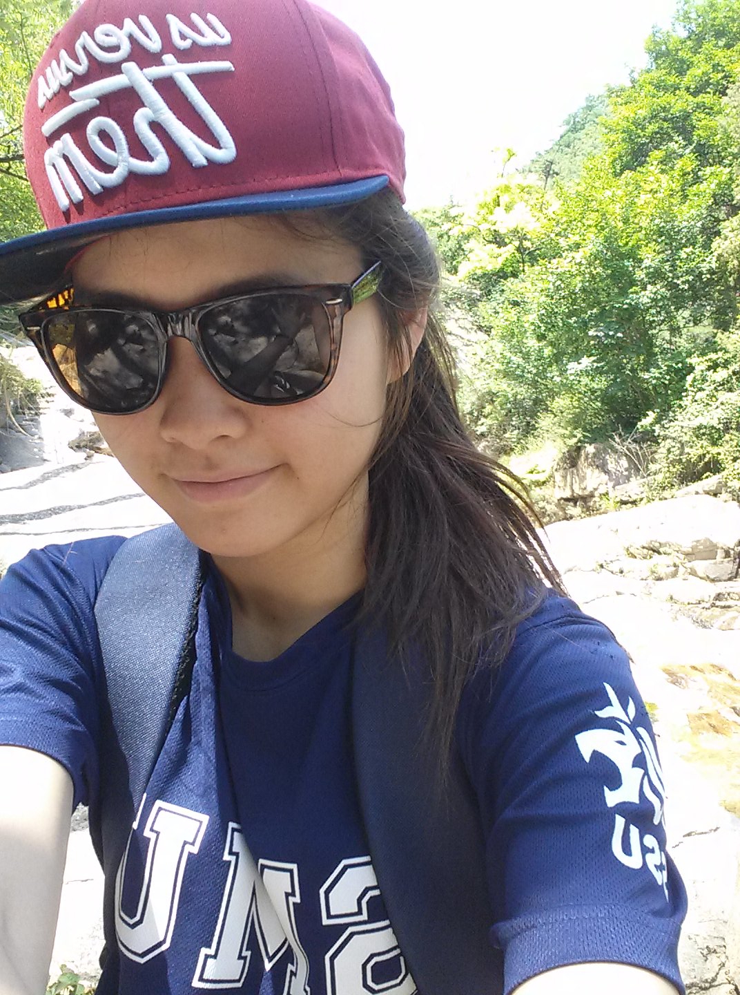
So i decided to stop by and post an instagram selfie. Haha.

Selfie first!
After about 10 min of resting it was time to go on. I reached my 3rd checkpoint, at 2.8km away from Baegundae. Good progress mich.

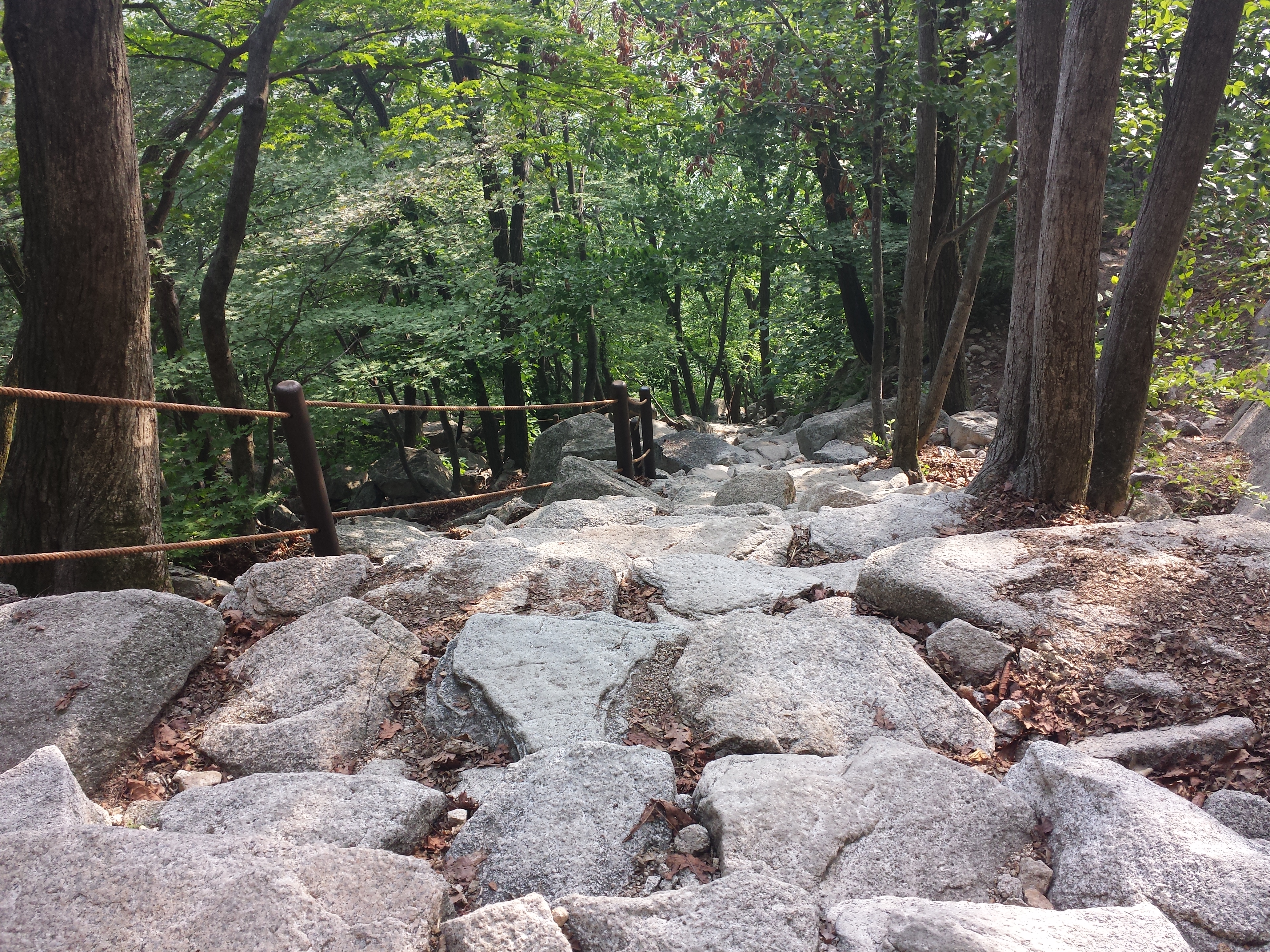
At this point, the scenery began to change. No more flat gentle slopes, slopes padded with rubber to prevent slipping, and staircases. Now we have stone staircases. Yay!

I reached my 4th checkpoint, which is a huge rest area with a carpark nearby. I bought another bottle of water and ate some of my chips while making use of the free wifi in that area. Haha how i love Korea and their wifis. The time now was almost 3pm, about an hour + since I first started my hike. I wasn’t even halfway through but i still thought my progress was okay.

Halfway rest point
This was when I got lost. Very lost.
So from the big rest area, there were 3 ways to go. The first way is the one I came from. The second one was the path on the right of where I came from. The third path was the one on the left from where i came from, after passing the huge rest area. Now, common sense should have told me that the right path is the path that’s after passing the resting point right. The point of the resting point is for it to be on the way right. But nooooooo. I just took a quick glance and saw that the path after the resting stop seemed to be leading towards the carpark, so I went on the other path. Very brilliant. 20 min later I found myself staring at a signage that says 3.5km away from Baegundae, pointing at the other direction.
At this point, my mood was just lakjdghalsjdghalka>!~!!!
I covered all that distance for nothing and now i’m again 3.5km away?!?!?! D:
Let me post some photographs of things i saw along the wrong path so you’d know that you’re getting lost as well if you see these things. Lol. Well at least there were some sights.

If you see this you might be lost pls turn back

If you see this you might be lost pls turn back
On hindsight I should’ve followed my gut instinct when the slope started going downwards but as usual i rationalized with myself that mebbe the slope is just going down a bit but will go up later on LOL wth was i thinkin
Anyway turned back and headed back towards the first resting stop. You know i always tell myself i shouldn’t get angry at bad situations because they always make for more interesting stories, like there’s always a silver lining. Well it’s always easy to tell myself that when i’m in a happy mood and feel like meh i’m a big gurl now who knows how to handle things maturely let’s not be angry, but HI WHEN IT HAPPENS IT’S A DIFFERENT STORY I JUST WANNA KICK ALL THE ROCKS DOWN AND MAYBE MYSELF DOWN BUKHANSAN YOU HAVE NO IDEA
So I went back to the rest point and took the other path. I took a photo of that signage there too that says about 2.5km away from Baegundae maybe, but the picture didn’t come out. On my folder it says it’s an empty file idk why?? Oh wells. I think I lost quite a couple of pictures that come out as ’empty’ :X most of them are just pictures of how the trail looked like but oh wells it would’ve been nice if i still have those pictures.
Along the trail, i saw tons of stacked rocks that i think people left to say that ‘i’ve been here’. In the past it was used to guide people on the right path without really altering anything in the natural environment, and also for meditation purposes. These days i think people just leave it to leave their marks without destroying the environment.

This picture is actually just a pile of rocks HAHAHA. Cuz i lost all the pictures of those stacked ones. Including the ones i stacked on my own where people were judgin when i was taking a photo of it 😦
Reached my 5th checkpoint soon after at 1.3km away from Baegundae! More than halfway through :’D

That was when the path went from tough to bloodyhell.
I just literally slumped against a rock, looked at the sky and thought God why.
And also, my mood at this point of time was just a bunch of regrets that i didn’t stay home to eat ramyun and watch some funny variety show or some tearful drama. Like i could be at a cafe now enjoying an iced latte wtf am i even doing out here. And it was a lot of self monologue declaring i’m not a hiking person and i shouldn’t be someone i’m not and next time just like sleep in and stay home bcuz yknow, that’s who i am.
But since I already made the decision, let’s take it all the way shall we. So I plugged in my earphones to play some of my favorite music (and also to stop hearing the buzzing of flies around my face as they try to fly into my nostrils and eyes and mouth and ears and basically just want to distract me so i will fall to my death) and went on my way.

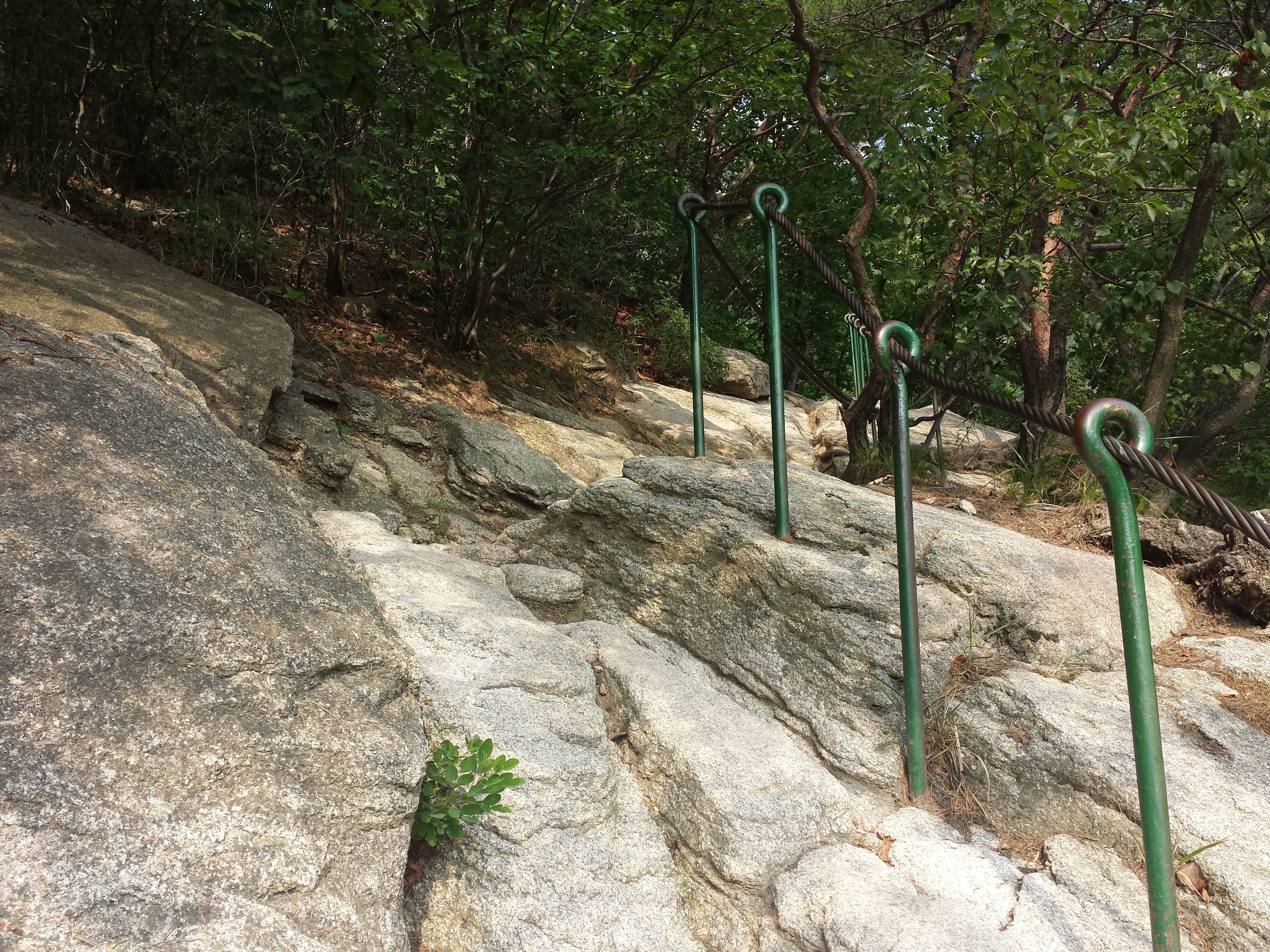
the path started to get a bit more precarious

maybe now’s a good time to turn back

they don’t even bother with a path anymore now it’s just slabs of rocks
Then I reached my 6th checkpoint. This is the point of time that i find out something very important.

THAT I WAS FREAKING ON AN ADVANCED PATHWOW THANKS
THANKS TO ALL WEBSITES OF BUKHANSAN THAT TOLD ME THIS PATH WAS ON THE EASY SCALE
YOU’RE PAYING FOR MY INSURANCE
At this point my mood was just.

Let me be one of the few brutally honest folks to tell you that this path is Advanced with a capital A.
After some deep breaths and constantly telling myself i’m a big gurl and i can handle things maturely (not), i turned up my music, used my kopitiam towel from the hostel to try to whack the flies like a deranged freak, and went on my way again.
The paths ahead of me gave me a nice balanced workout that involved all muscles on my hands and arms as i haul myself up rocks. Pretty sure from below i look really unglam on all fours with my butt sticking out like ugh why

slabs of rocks

how is this even a path
At this point I turned back to look at the path i’ve conquered and man i was so proud. Look at those huge rocks that i owned. Hah.

And then i found my 7th checkpoint!! 0.4km to the peak! Mind you. The map earlier on that pointed out the distances from each trails and the difficulty levels, predicted that it will take 20 min for me to reach this checkpoint. It took me 40 minutes. I kid you not. After every 10 huge rocks i had to sit down and catch my breath. Every timing they predict for you, you should times 2 because you’re probably a lot lousier than the average hiker. Really. This isn’t a video game when you are usually faster than the average and better than the average, NO. When it comes to the real world you’re probably twice lousier than the average, it’ll do you good to think that way….. #pessimistic
On hindsight when I look at my pictures, they don’t look very difficult. And maybe you’re thinking nah that’s not as steep or exaggerated as you make it out to be.
IT IS. TRUST ME. IT’S WORSE THAN IT LOOKS. VERY MUCH SO.
My thighs ache just by looking at the pictures only because I’VE BEEN THERE AND DONE THAT IT’S NOT EASY IT’S ADVANCED FOR A REASON like if you’re a first timer like me, you would never have had ‘advanced’ slapped so hard across your face like this one maybe it’s just that i’m really lousy but well like i said, assume you’re lousy first until proven otherwise

7th checkpoint, 0.4km away!
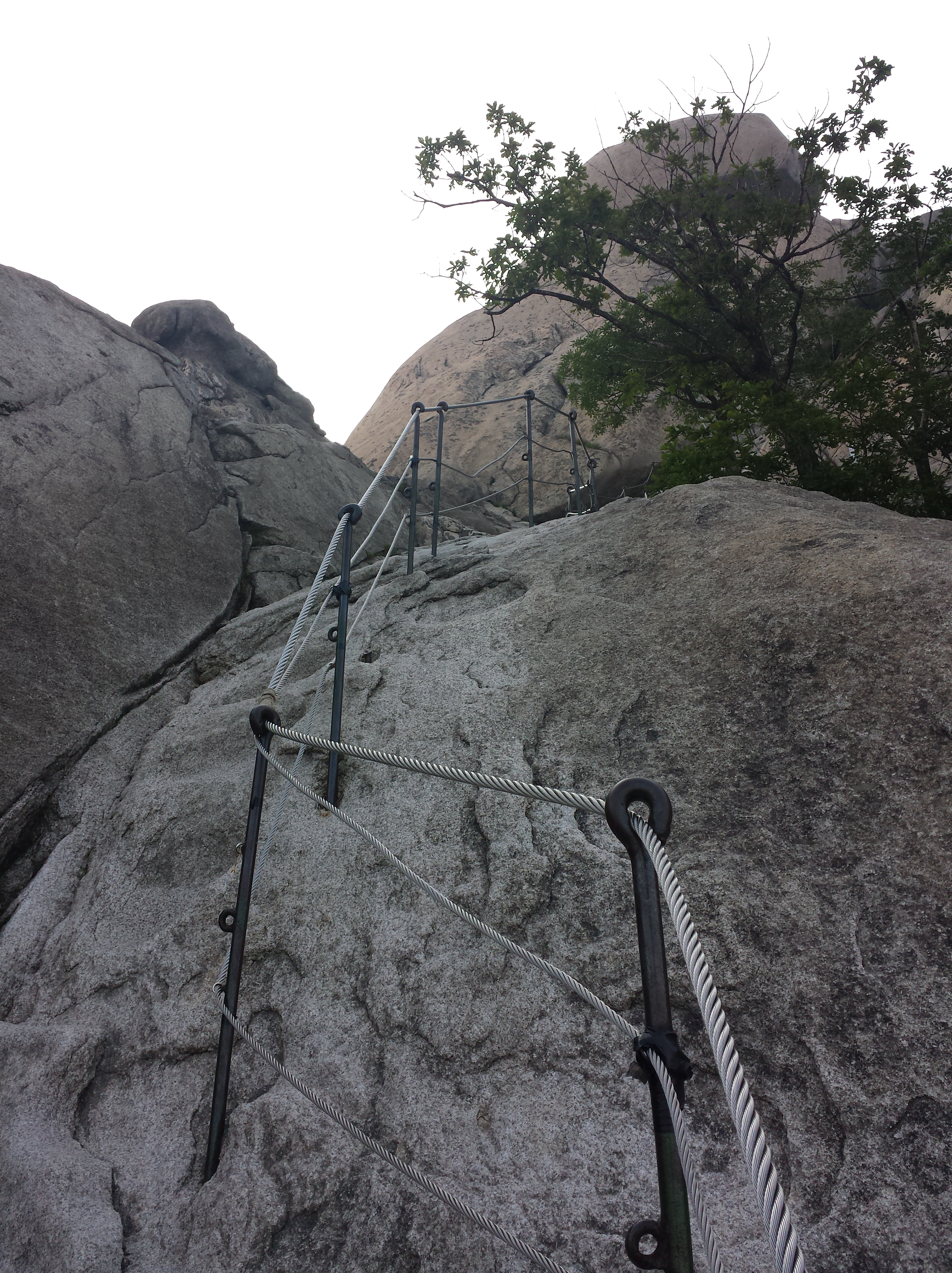
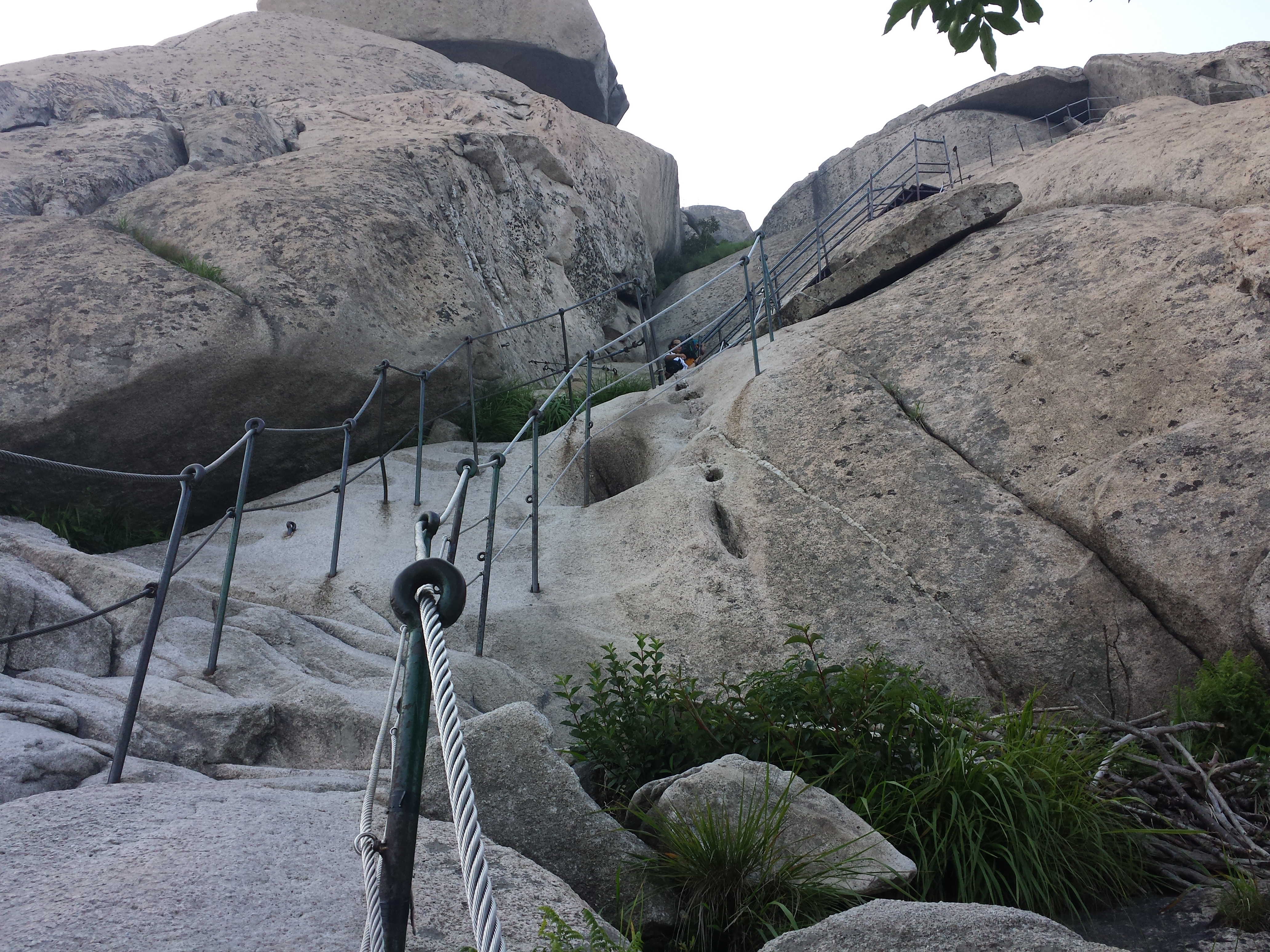
It was a killer staircase upwards from this point on, but seriously, i was so happy to see staircases i was ready to cry for joy. All those rocks really took the energy out of me 😦 i also slipped so often i questioned how i was still alive I scaled the staircases much faster than i did the rocks.

I’m beginning to see the light!!!
And then my 8th checkpoint is there in all its glory, 0.3km from Baegundae! I’ve only traveled 100m from my previous checkpoint!!!?

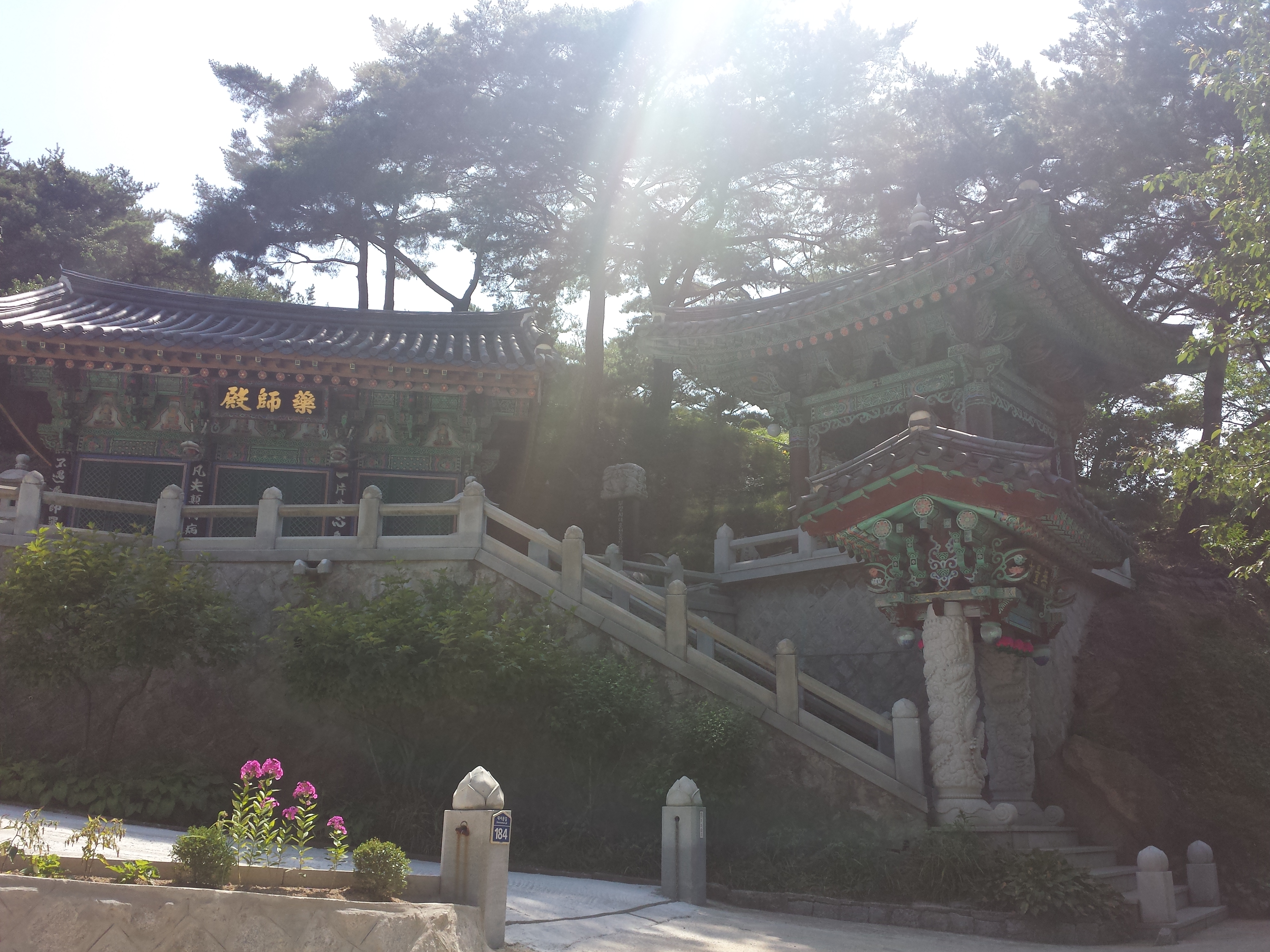
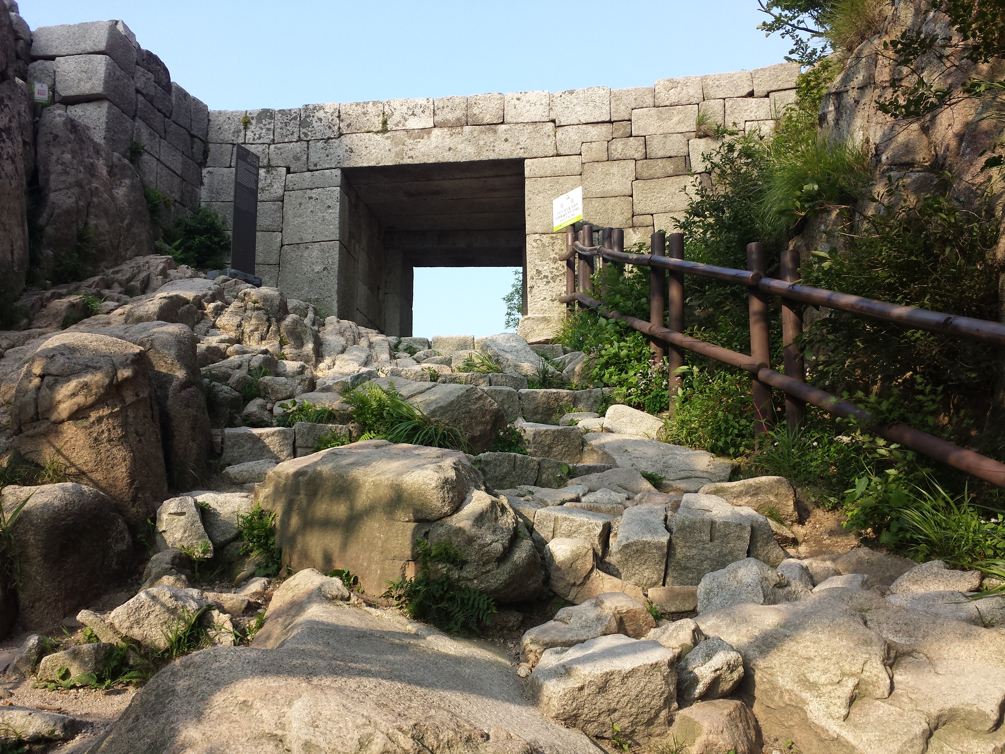
Throughout the hike i kept questioning where’s the fortress wall that i was supposed to see along this path?? I guess my question was answered here, near the peak.

i THINK this is the fortress wall don’t quote me on it

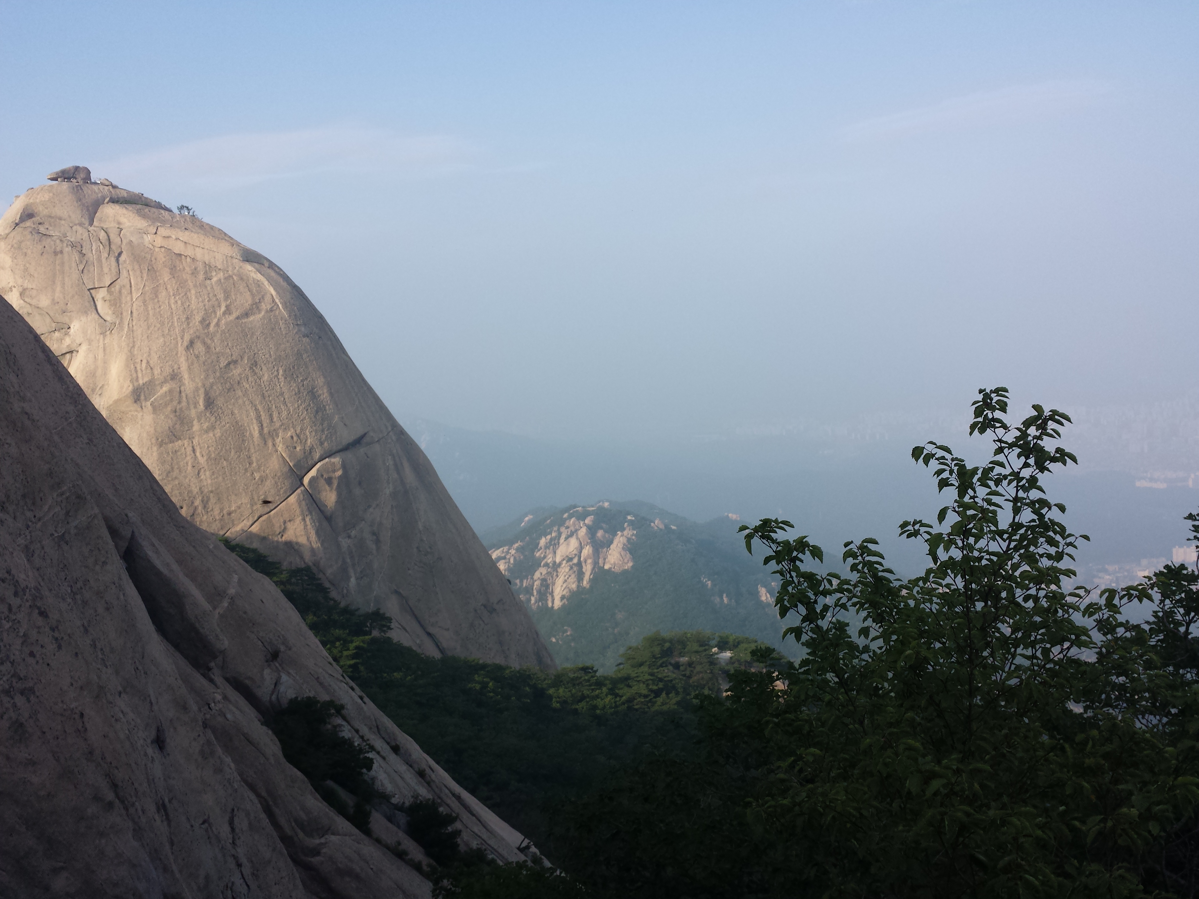
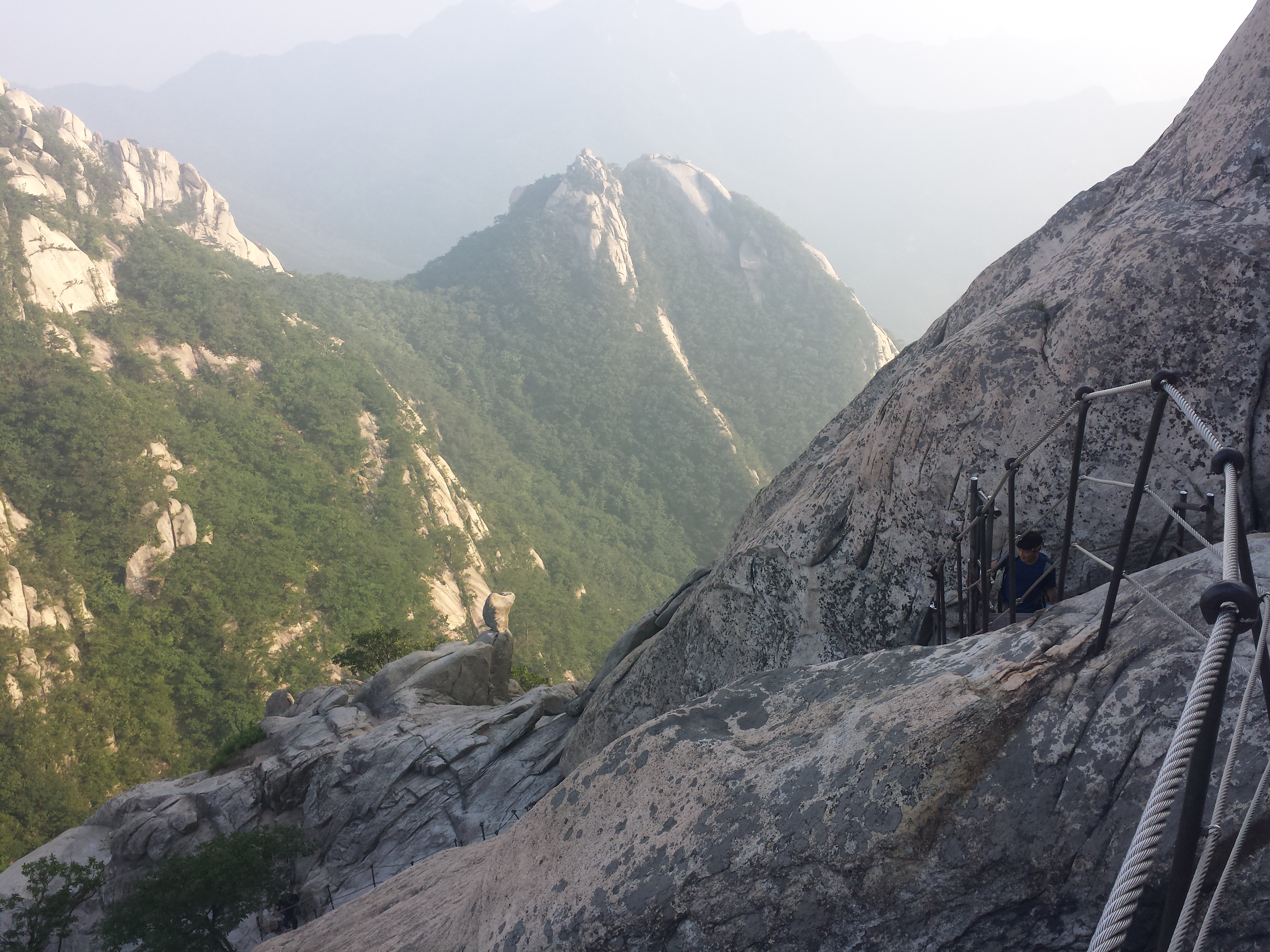
And then i was beginning to see the view. It was sooooo rewarding after all of that! Unfortunately the skies were hazy (as usual) so there wasn’t much to see in the distance.

 I
I
t was also really windy here which was nice and refreshing! But then at this point the path really did it for me. Like that’s literally a vertical rock i’m looking at. Who do you think i am man. Who do you think you are to say that this path is easy and manageable and then give me a vertical rock. Tell me i’m not exaggerating man. I can’t be the only one feeling that injustice. I can’t be the only loser out there.

how is this a legit path it’s literally vertical

i’m tired just looking at the pic
At this point, one of the middle-aged ladies who overtook me halfway up the trail (all the middle-aged people are 1000x fitter than me i’ve long accepted that) walked past me on her way down. Lol. like i’m still otw up when she’s alr otw down.. orz

I really like this photo because it’s a perfect representation of how precarious this climb actually was. Haha.

And then I was at the peak before i knew it. The feeling of stepping at the very top of Bukhansan after so many hours of climbing, thousands of buzzing flies, lots of near-death slips, constant cursing and regrets and thoughts of turning back… the feeling of reaching the top after all of that was…. unbelievable. I don’t even know how to say it. Words fail me.

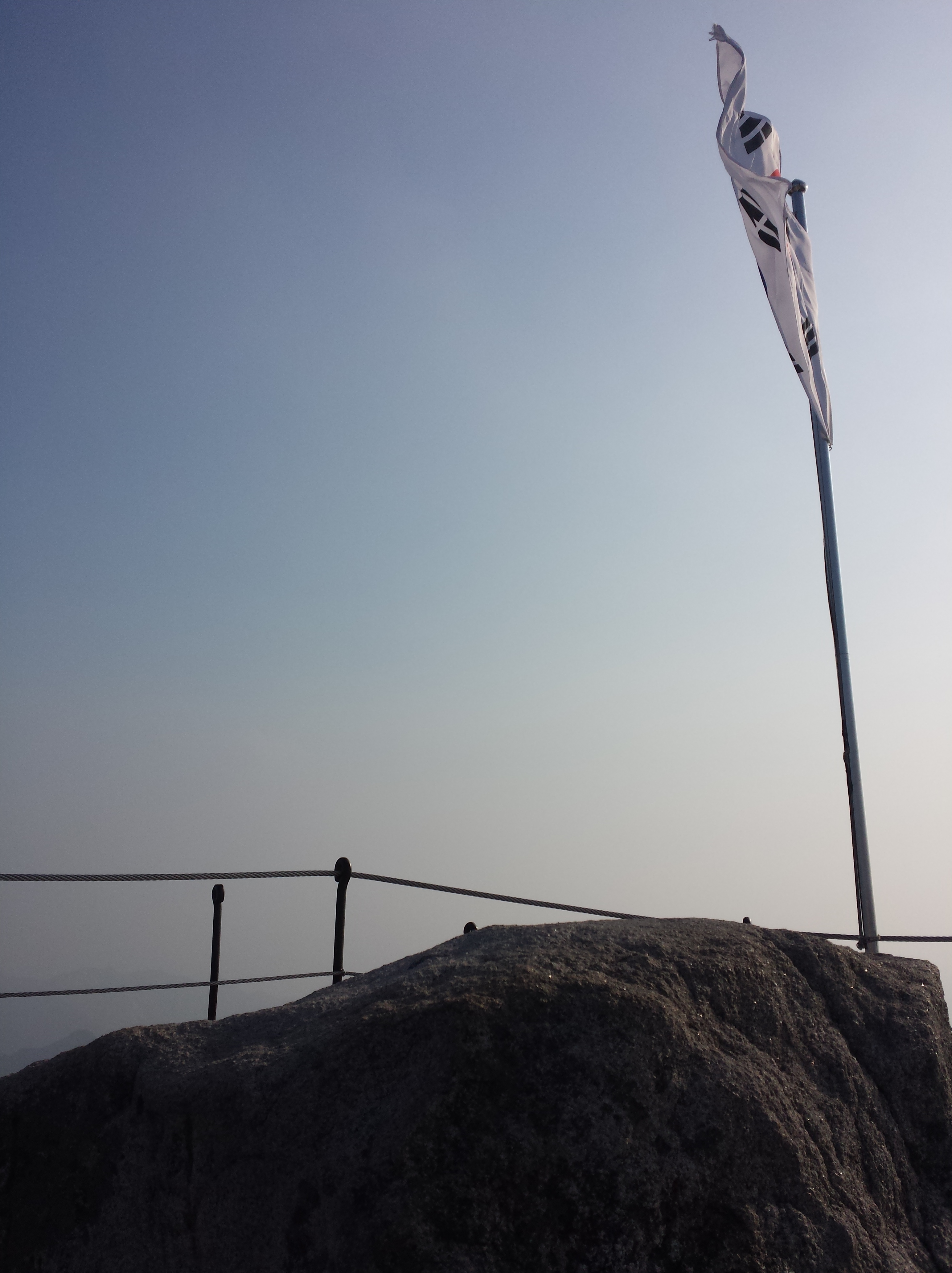
The famous rock and flag at the top.
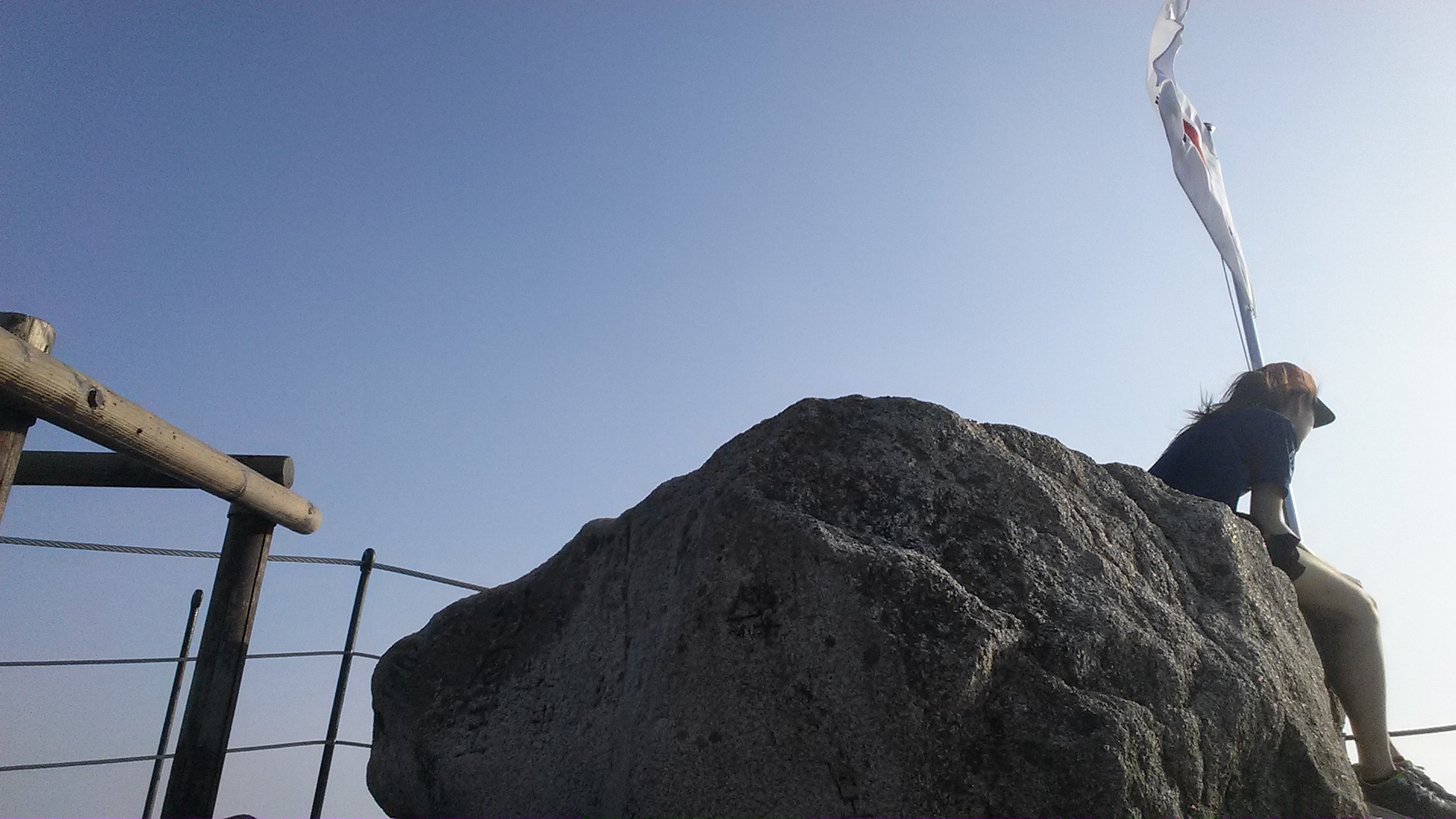
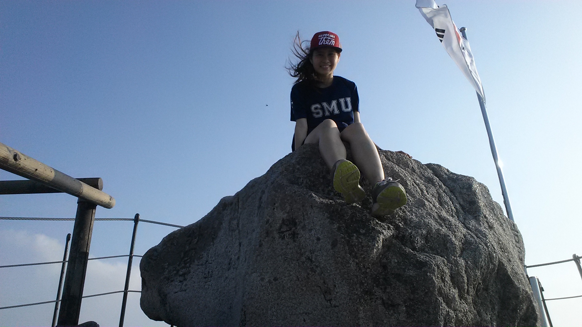
Of course this calls for a picture of myself. I wanted a full shot but no one else was at the peak. So it was photoshoot time!!!! Propped my bag against a rock and my phone camera on top of it ,set the timer and scurried over to the rock to pose.

This picture would’ve been legendary if someone had taken it from top-down, to include the view that i was looking at. But we can’t always have everything and honestly i was just glad i managed to get pictures of myself at all without anyone’s help.

you did it mich :’) #smu #productplacement
I spent 15 min or so hanging out at the peak and taking videos and pictures and then others started to come up so I went down a little bit and sat among the rocks to grab a snack and admire the view some more. And then it was time to go down.
At this point, it was around 5pm meaning I’ve taken almost 4 hours up, including the whole getting lost part. That was really late actually, Sheryl and the rest only took 4 hours up and down haha.

The view near the top.

A duck shaped rock


I slid down this part, no kidding

Back to the latest checkpoint and I saw the sign leading to the Baegundae Information Center, which was where the 1.9km hike would start from, and the same place that Sheryl said it was ulu. It’s time to find out where that elusive starting point is actually at.
Hence I embarked on that trail down. It was still quite crey though. Lots of rocks later i finally got out and saw the starting point of this trail.


This was the Baegundae Information Centre where the shorter 1.9km Baegundae trail is supposed to start. Turned out it wasn’t actually an accessible starting point, unless you drive up so 
I had to walk quite a distance down the car route until i get back to the main road, hopped onto a random bus that took me to a random station, and finally returned to my hostel.
Bought a packet of ramyun to cook back at the hostel and gave myself a long long long long deserved sleep. ❤
Worth it? Yes. I think I got a lot of unforgettable memories and I’m very proud. But i know i wouldn’t do it again lol.
Anyways.
How to get to Bukhansan (Bukhansanseong trail to Baegundae peak): Take the subway from Gupabal Station, Exit 1 and take bus 704 to the entrance of Bukhansan Park.
836m tall, 4km long. Always remember.